7

According to the WikiVoyage page on Bergen, The city center is surrounded by a group of mountains and peaks known as the Seven Mountains. I've read that the most central of the mountains, Mount Fløyen, has both a funicular railway and well signed paths, so walking up that one should be fine.

What about the other of the seven mountains? Do they have well signed walking paths too? Or is the situation with those more like hiking most of the Munroe Mountains in Scotland, where you really need to buy the appropriate 1:25k hiking map?

3
  • See also The Great Outdoors.
    – gerrit
    Commented Jun 27, 2013 at 20:29
  • @gerrit My thinking was to ask there for advice on maps if one was needed, routes to take if it's hard etc, where as here seemed the place to ask if it's something simple or something TGO worthy!
    – Gagravarr
    Commented Jun 27, 2013 at 21:27
  • Well, I didn't say that the question is off-topic here (I'm not sure, it probably fits on either), but I just figured that anyone browsing this question may also be interested in The Great Outdoors. Just trying to get a little bit more publicity for the latter.
    – gerrit
    Commented Jun 27, 2013 at 22:03

5 Answers 5

2

According to one of the local companies, Fløibanen:

The directional signs on the Bergen mountains show the main trails, which are clearly labelled on tour maps. Be aware that recent storms, snow and ice, or vandalism, may turn these signs. This makes it especially important to show respect for the weather – and fog and weather changes can come suddenly in the mountains. It’s always wise to bring a good map and compass.

This would seem to indicate that Mount Fløyen is not alone in having its walking routes well signposted.

2

The main set of mountains for hiking when starting from the city centre are the 2/3/4 (depending on how you count!) to the north-east of the city centre, including Fløyen (the one with the funicular railway) and Ulriken (with the cable car). There are a decent number of proper walking trails up and around these.

The trails are largely divided into "green" ones, which are well made paths and quite flat (I believe which often get used for cross country skiing in the winter), and dotted black ones, which are often quite steep and not made up.

Two things to be aware of navigation wise - there aren't that many map boards posted, and while there are proper signs at each junction they are by name but without distances. Unlike similar paths in America, there aren't distance markers as you go, and unlike similar ones in the UK there aren't distances at the junctions. Map boards were a lot less common than in similar areas in other countries I've hiked in.

If you just want to hike up Fløyen, I'd say you're fine with just a local tourist map - they normally go to about there and have most of the walking routes. For a bit more than that, you might be fine with using a local tourist map to get you to the start of a trail, then take a photo of one of the big board maps you find at the start. For anything else, get yourself a map before setting off. There are some great hikes very close to the city, some lovely lakes for swimming in, stunning viewpoints etc, and it'd be a great shame to miss out on any of them through not having a map to find them!

1
  • 1
    Good answer! I'd probably add that the trails at the top of Ulriken are much more "rugged" and over more broken ground than the Fløyen trails which are much smoother, something which caught me out slightly when I visited! Commented Jul 17, 2013 at 7:46
2

It is true that there aren't distance markings on the trail junction signs, but I find it difficult to get truly lost on any of these trails. If the weather is just semi-nice, there will be tons of people out, and still some out in the rain, which you can follow or ask. One of the popular, longer hikes people do around here is called "Vidden", which is a plateau between Fløyen and Ulriken and takes about 4-9hrs depending on your speed, etc.

Two great resources for all trails, cabins, and outdoor things: UT.no & DNT

If you'd like to get a map of the mountains and their trails as well as get suggestions and answers to questions, you can buy one at the DNT storefront on Marken (near the train station; google map "DNT, marken, bergen"). Though, I don't have one and haven't found it necessary for trails around Fløyen and Ulriken.

Here is a link to the map.

God tur!

2

You've already gotten quite a few good answers, but most of them are focusing on the mountains to the north-east of the city center. I'll try to give a more thorough answer, including all of the 7 mountains, and how to reach them.

First, let's look at a list of the 7 mountains:

The 7 Mountains:

  1. Lyderhorn (396 MAMSL*)
  2. Damsgårdsfjellet (317 MAMSL)
  3. Løvstakken (477 MAMSL)
  4. Ulriken (643 MAMSL)
  5. Fløyen (400 MAMSL)
  6. Rundemannen (568 MAMSL)
  7. Sandviksfjellet (417 MAMSL)

*MAMSL: Meters Above (Mean) Sea Level

The 7 Mountains Hike

The most obvious way to reach all 7 mountains, is doing "The 7-Mountains Hike" (7-fjellsturen). This is a 34 km hike, with a combined accent of 2400 meters. This is a challenging trip that will take approximately 8 hours for an adult man in good physical condition and not including any breaks. This guy did it in less than 4 hours, but note that the headline in the article is: "Hardly particularly healthy". As you probably realize, this is a trip you should be well prepared for, but it's not unfeasible. Each May there's an organized hike where more than 8000 participate, and most finishes.

You won't see many people carrying maps, and on a sunny day it shouldn't be necessary either. However, most people you'll see up there have been hiking on these mountains many times before and knows the trails well. You will also likely be among very few going the entire 7 Mountains Hike if you choose a random day.

Gravdal, the starting point is a 15 minutes bus ride from the city center, and the bus goes approximately every 30 minutes.

Suppose you don't want to do the entire trip, there's the possibility of only doing the "4 Mountain Hike", which is only the 4 last mountains. If you do so, you may take the bus up to where you start your hike to Ulriken (the bus stop is called Montana). (To nitpickers: Yes, the official 4 Mountain Hike starts by Årstad VGS, but it's easier to find, and easier to hike from Montana.) More info below.
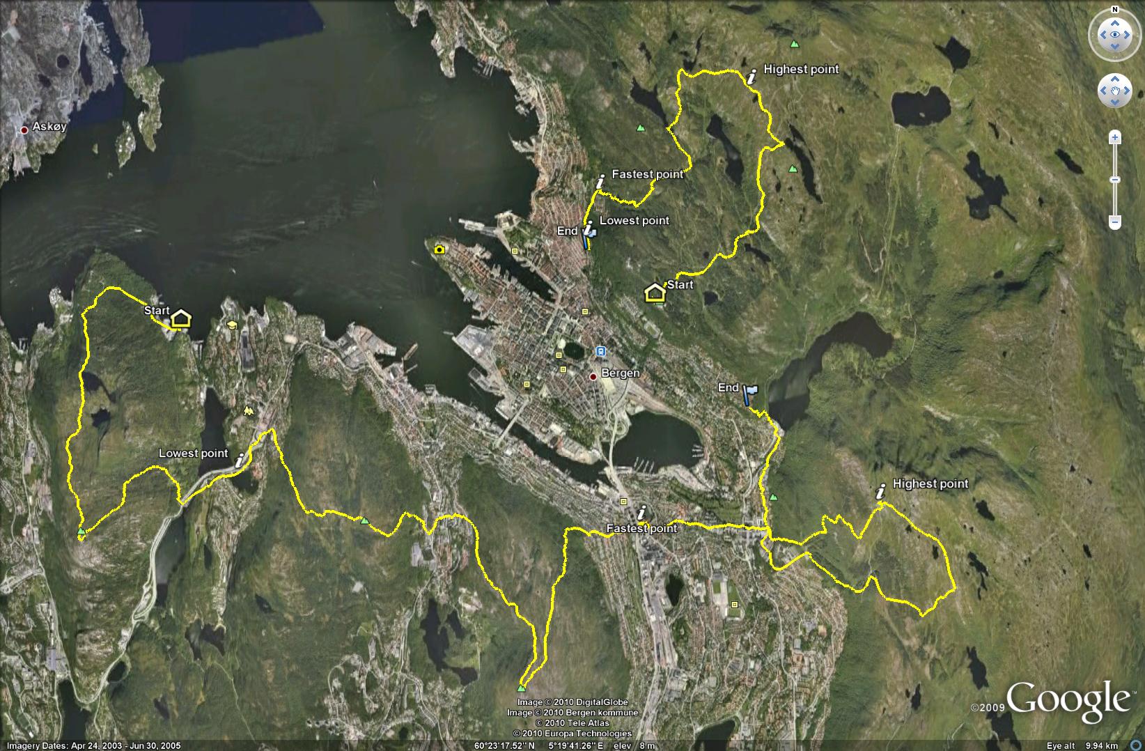
enter image description here

There are signs telling you which way to go, but sometimes these may be hard to spot. If you're by the road, green signs like the one below show you which way to go to find the starting point of the hike. There are such signs for all of the mountains, but you need to be in the right spot to begin with. The tourist information can tell you where to go.
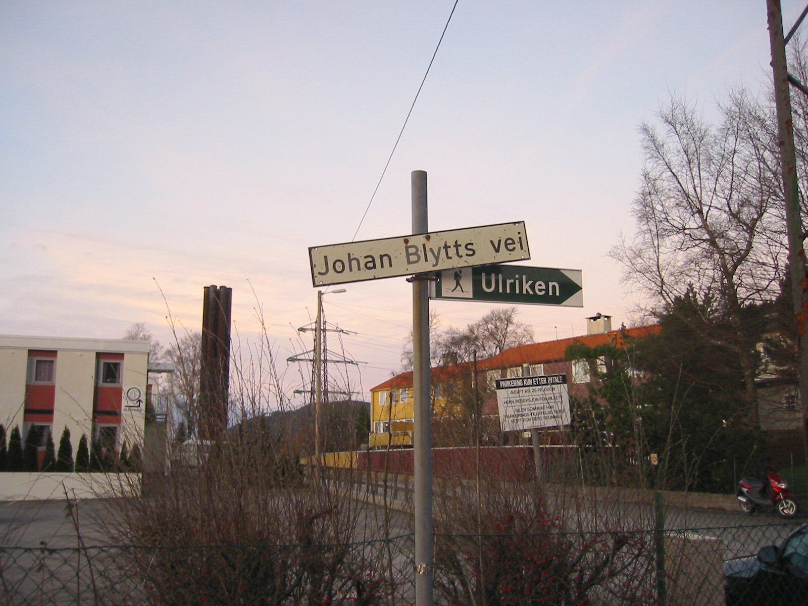
http://www.hassall.no/galleri/originals/3388.jpg Foto: John Hassal (http://www.hassall.no/index.php?pageId=galleri&evtId=369)

Once you've started your hike, you'll see different signs, such as the ones below. As you can see, they don't show you how long the hike is, only the direction. You also have signs on the way telling you if you're on the right track.
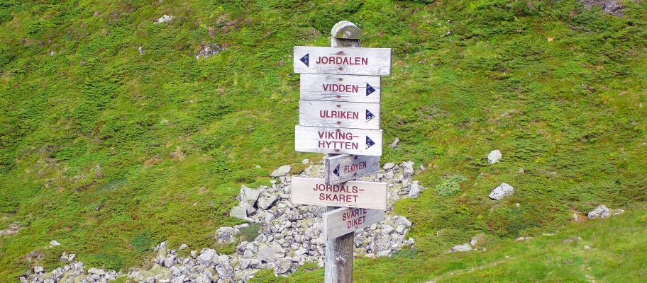
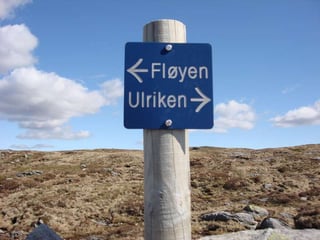
enter image description here

enter image description here

Hiking suggestions:

1: Vidden

Unless you're determined to do the 7 Mountain Hike, your time is probably best spent walking over Vidden. That's a hike going from Ulriken to Fløyen and offers great views over the city and its surroundings. You can shorten the hike by taking Fløibanen and/or Ulriksbanen. If you walk up from Montana to Ulriken over the plateau to Fløyen, it will probably take you about 5 hours. Most of the path is over rocky terrain, but there are a couple of sections where it can be quite wet and muddy, so waterproof shoes are sensible.

2: Pick and choose

If yoy're in Bergen, visiting Fløyen is an absolute must! If you choose to walk or take the funicular is up to you. You can walk from Fløyen to Rundemannen quite easily, but in my opinion that's not worth the trip. (You'll pass Rundemannen if you walk Vidden).

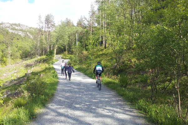
The hike to Sandviksfjellet is also simple, and might be a nice trip if you want to walk around a bit. You won't risk getting any dirt on your shoes if you go to Sandviksfjellet, as the paths around Fløyen all look like the ones below (that's actually the path from Fløyen to Sandviksfjellet and not just a random one).
enter image description here

Going up and down Ulriken is also a nice trip, and you can take the cable car one of the ways. The view is great, and there's a restaurant etc. on the top. It's hard to go wrong once you get to Montana, and that's a 20 minutes bus ride from the city center.

My personal favorite is Løvstakken, which has a great 360 degrees panoramic view. From the city center it's easiest to take the bus to Solheimslien and follow the signs and path. Also this path is hard to miss. If you're only going up and down Løvstakken you don't need maps/compass. As with Vidden, it might be a bit muddy if it's been raining.

Shoe wear: I always use running shoes, regardless of which of the mountains / hikes I'm doing. There's a big chance it'll be wet, but I find hiking boots to be a bit overkill.

1

I used to live in Bergen, between 2011 and 2012. I went there during my Erasmus exchange and did maaany times the 7 mountains that the city has around it. It's quite well signed, but as some pointed out, it's not perfect.

However, most of the hikes are between 3 and 5 hours. Depending on your fitness level and the weather conditions. Since it can be hard, specially in winter time, to walk uphill due to the snow and definitely because of the ice.

I wrote a blog post, almost 2 years ago, Bergen hiking: The ultimate guide for the Seven Hills city. I reckon that the name of the blog post sounds super amazing. But to be honest, it's quite well detailed. You have the transport indications for how to get to the starting point of each of the trails, and I prepared the hiking routes over a map too. There are even proposed combination of mountains that you can hike during the same day, without having to do mountain running or without walking 10-12h in one day.

Feel free to take a look into it!

You must log in to answer this question.

Not the answer you're looking for? Browse other questions tagged .