5

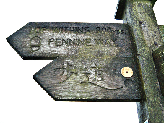
This summer hundreds (maybe thousands) of tourists and literary pilgrims will make the trek from Haworth to the ruins of Top Withens. For the most part they will start at the Bronte Parsonage and follow the path across the falls, climb the ravine, and join with the Enfield Side Road to reach the ruin.
enter image description here

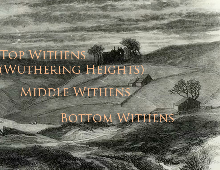
I wanted to attempt an alternate route that begins at a place I hope this question will identify. The illustration for the 1872 edition of Wuthering Heights is an engraving...
enter image description here

I have used Photoshop to put labels on the three farmhouses. It is known that the artist's depiction of the house called Top Withens is fanciful, and that's not the point. Its location is real and the three farmhouses are known to have existed. Where did the artist (known to be Edward Morison Wimperis) stand? The path commonly used by literary pilgrims does not provide this vantage point.

The foreground of the illustration appears to show an old drove which crosses a country lane. The three farmhouses are shown in a straight line which runs parallel to a dip (possibly a ravine) on the left. But there's no orientation. The view could be from the from the east, or looking north or even looking west. The shadows are wrong for a southern aspect. The ruins of Bottom Withens and Middle Withens are gone by now, at least I cannot find them on Google Maps' satellite view and there is no indication on this marvellous overview provided by Google.

I expect that it is within a two mile radius of Top Withens, but would not have the time or stamina to explore the entire area. I accept that roads and structures may have been built in the intervening 140 years, but still the artist's vantage point should be locatable within a reasonably precise radius.

1 Answer 1

6

Take a look at this photo and this Google map. I believe that the photo was taken from around about the site of Bottom Withens (which I think is at 53.818568, -2.025406 on the map - North East along the Pennine Way from Top Withens - a distance of some 520 metres) as we look. I think that the 520 metre distance makes sense - very much farther apart and, even though they are in a line, they'd hardly be related. Also, assuming perspective is accurate in the engraving, the buildings don't look to be a huge distance apart. In the photo, however, there appears to be some foreshortening, consistent with a zoom lense.

Given that the photo is from a bit closer to Top Withens than the engraving, it's interesting that the current path hooks around to the right behind what I'm assuming to be the ruins of Middle Withens, following almost the same route as the path in the engraving. It's a pity that the photo is narrow and tall as the rise to the right of Top Withens in the engraving is kind of suggested in the photo, but I would have liked to have seen a bit wider view.

4
  • Are you thinking the sort of rubble in the photo at midrange are the ruins of Middle Withens?
    – Gayot Fow
    Commented May 6, 2015 at 17:27
  • 1
    I think they could very well be, yes. (Little bit of background - although I'm not at all familiar with that spot, I live about an hour away, and very close to similar moorland with similar ruins.)
    – DaveP
    Commented May 6, 2015 at 17:28
  • Are you saying that the artist was somewhere near the Pennine Way, between Top Withens and Stanbury and looking approximately West South West?
    – Gayot Fow
    Commented May 6, 2015 at 23:54
  • 1
    That's right, about 700 to 800 metres from Top Withens, on or near the path that would have existed then and is now part of the Pennine Way.
    – DaveP
    Commented May 7, 2015 at 8:05

You must log in to answer this question.

Not the answer you're looking for? Browse other questions tagged .