2

As per U.S. Route 24 (Wikipedia), the western terminus of U.S. 24 is located near Minturn, CO, where it joins with Interstate 70.

Map of the U.S. Route 24 Western Terminus, connecting with interstate 70

Having just driven this road, I noticed that the western-most highway milepost marker was "143," not the expected "0".

Why is this?

3
  • 1
    It is likely because it originally started from Grand Junction, 143 miles from Minturn.
    – xngtng
    Commented Sep 20 at 18:01
  • @xngtng That may be it! If you have one or more good sources, please expand your statement into an actual answer.
    – Digger
    Commented Sep 20 at 18:06
  • 1
    This is pretty common for older highways which were partly overlaid by interstates. Sometimes the old US route is overlaid (usually if it joins for a bit and then diverges), sometimes as here the old US number is dropped if no longer needed.
    – Jon Custer
    Commented Sep 22 at 19:21

1 Answer 1

2

From Wikipedia's article on US Route 24:

When the U.S. Numbered Highway System was started in 1926, US 24 in Colorado was designated US 40S. It began in Grand Junction and went east along the current I-70 corridor to Minturn, from which it followed the current route to Limon. From Limon east to the Kansas border, the current US 24 was designated US 40N. US 40S west of Limon and US 40N east of Limon received the US 24 designation in 1936, when US 24 was extended west from Kansas City, Missouri. The segment between Grand Junction and Minturn was decommissioned in 1975.

In addition, the AAroads website notes that

U.S. 24 historically ran west alongside U.S. 6 from Dowd [close to Minturn – ed.] to U.S. 50 at Grand Junction. The long concurrency was eliminated with approval by the American Association of State Highway and Transportation Officials (AASHTO) on November 15, 1975.

So when US-24 was originally designated in 1936, it ran concurrently with US-6 from Grand Junction to Minturn (143 miles away). In 1975, this westernmost segment of the highway was "de-designated" from US-24. It seems likely that the mile markers were simply left as they were when this was done, resulting in US-24 "starting" at mile 143.

Finally, a scan taken from a 1975 edition of the Rand-McNally Road Atlas:
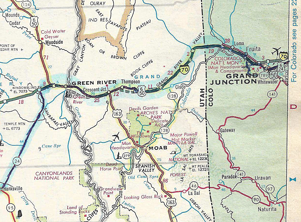
enter image description here

This appears to show US-24 entering Grand Junction but not leaving it, suggesting that this was the terminus of US-24 at the time.

5
  • The above comment on Wikipedia is unsourced, so you might want to wait a few days before accepting this answer in case someone comes up with a more authoritative answer. (If you do want to accept it, of course — don't want to presume.) Commented Sep 20 at 19:37
  • Here is another reference if you want to elaborate (search for AASHTO): U.S. 24. For another interesting comment, search for milepost 143 on that same page...
    – Digger
    Commented Sep 20 at 22:15
  • In addition, U.S. 24 in CO shows that there is a non-zero milepost at the western terminus...
    – Digger
    Commented Sep 20 at 22:28
  • 1
    @Digger: Edited to incorporate the AAroads website information. Thanks! Commented Sep 22 at 13:57
  • 1
    paper map !!!!!
    – Fattie
    Commented Sep 23 at 21:22

You must log in to answer this question.

Not the answer you're looking for? Browse other questions tagged .