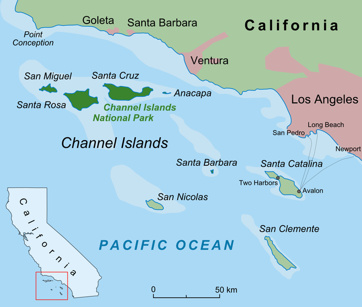
The two main ways to get there via boat are via Island Packers who leave out of Ventura, or Truth Aquatics who leave out of Santa Barbara. If you're scuba diving, Truth is great, but for most trips, Island Packers is cheaper and has a better schedule. You can also fly to Santa Rosa island, which has a small dirt runway, accessible from the Camarillo airport.
There are four accessible islands, with increasing remoteness and difficulty as you move further West in the channel. Anacapa is the closest, it's a small island but still has many interesting features. Santa Cruz is the largest island, has two NPS owned camping sites and two harbors, and is the most 'developed' of the islands. Around half the island is retained by the Nature Conservancy, and not open to the public. If you only have time to visit one island, I recommend it. Santa Rosa is the next further out, and is also quite large, with a few restored areas such as Lobo Canyon which are beautiful. It's windy, and conditions at the lone camp site can be difficult, but its my favorite. San Miguel is even further out in the channel, has no dock and is the most remote, I've yet to travel there.

